First off, if you've taken the job of trying to build a world from scratch instead of working with a pre-existing setting (which is probably the more satisfying of the two pursuits), you need to make one major conscious choice before going any further: do you build from a macrocosmic perspective or a microcosmic one? That is to say, do you want to have a cursory understanding of everything going on at a planetary scale for your world (and detail in the finer points as your players explore the setting) or do you prefer to start with a regional focus, having all the details mapped out for a smaller section (a continent or a kingdom and its neighboring territories, for instance) and discover the characteristics of the outer-regions as your story necessitates them? There really isn't a right or wrong answer, but it's important to know your limitations and expectations. If you know your players are going to want to explore everything, or if you intend to create a globe-trotting plot, you might consider going with the macrocosmic approach. If you like things on a smaller scale at the beginning of a campaign and prefer them to branch out slowly over time, your best bet is probably the microcosmic approach.
For purposes of this series, I'm going to focus on constructing a world following the microcosmic approach. The world is meant for low-level PCs, and the process will be done in real-time, so the actual, finalized result is unclear (ie. unplanned). My aim is to keep it as generic and easy to follow as possible. Ordinarily, I'd take into consideration some of the ideas and details that I'd have already planned for a new world; but seeing as how none of that has been pre-planned and this is all one novel exercise in creation, I'll simply start with just the geography and decide on history and civilization after I know what my environmental constraints are.
So, on to the details. We need clear delineations between prominent landmasses and bodies of water. How realistic you want these to be is, of course, a matter left entirely to your discretion. The drawing can be as rough or as polished as you need it to be – the only really important details at this juncture are the relationships and layout of the geographical features; nobody expects professional cartographer grade materials (yet). For simplicity, and at least a degree of accuracy, I turn to the wondrous marvel of procedural generation. The site I use for this tool is the following:
You
can make a number of tweaks here for the final presentation and can
adjust the amount of water that covers the surface of the generated
world. I chose the Mercator projection, mainly because it's the
easiest to edit and incorporate into this design process. I set it to
the Atlas map palette because the muted colors will make it easier to
modify the image in Photoshop (we'll be doing a lot of
post-processing of the map in subsequent steps.
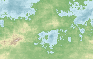
I scrolled through several randomly generated seeds before selecting one that I think will work well. As these are meant to represent the entire planetary surface, and I am intending to only use a small region of it, I'm going to increase the image size so I can preserve as much resolution as possible – it won't matter too much in the end though – the actual image is going to be drawn over heavily and may not be discernible underneath all of the layers. I selected the random seed 393591050, in case you want to follow along with the tutorials. This is what it looks like:
 I'm
not a geographer, geologist or cartographer by any stretch of the
imagination; so if you want 100% veracity in how to arrange your
topographical features and details, you won't find that here.
Fortunately, the image generated gives us a few clues as to how to
proceed. Also, it's a matter of preferences as far as approch to
realism goes, so I'll try to be as realistic as possible.
I'm
not a geographer, geologist or cartographer by any stretch of the
imagination; so if you want 100% veracity in how to arrange your
topographical features and details, you won't find that here.
Fortunately, the image generated gives us a few clues as to how to
proceed. Also, it's a matter of preferences as far as approch to
realism goes, so I'll try to be as realistic as possible.So, as mentioned above, I'm not going to use the entire generated image, just a small part of it. As I expand outward in the campaign (IF), I can refer back to the original map to figure out what sort of topographical stuff is going on.
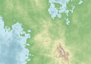
I went with a region that encompasses some of the bodies of water (mainly because I enjoy Dming naval battles and it also presents plenty of opportunities to pepper mysterious islands filled with ruins and other adventuring opportunities). It also appears to incorporate at least one major peninsula, which is indicative of a converging point between mutiple mountain ranges; there's also a desertified area (apparently), several large islands. The one thing that doesn't sit right with me is that it's in portrait layout. I'll flip it around to a landscape view that I find looks better. Again, I'm not looking at the entire world right now, so I can make that call and not feel too guilty about it...
The
arid-looking brownish patch is what I am going to work with as a
desertified region, and as such, I'll make the general assumption
that the equator is just a handful of latitudes below the bottom
perimeter here.
 This
post has gone on for quite a while, so I'm going to pause for now.
When we pick up, we'll be loading this image into Photoshop to clean
it up and make it a little more cartographesque.
After that, we can start to pinpoint the major geographical elements
and start thinking about what would be logical political boundaries
for the nations that will make up this section of the world.
No comments:
Post a Comment